Route of Ganges River
You're here because you're looking for information about the route of Ganges river and a Ganges river map, hopefully you'll be satisfied with the Ganges maps below..
Search this siteThe route of Ganges river is long and winding meaning that it directly and indirectly affects the largest population of any river in the world. It is certainly one of the greatest rivers in the world and continues to be a lifesource for the millions upon millions of Indians who depend on it.
The Ganges river is in the North of India and originates in the Himilayas before draining into the sea in the Bay of Bengal. I have outlined some of the key stages of the route of the Ganges river and you can find some maps further down the page.
Step 1: Uttarakhand (state + Start)
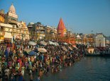
Step 2: Kanpur, Soron, Kannauj, Allahabad, Varanasi, Patna, Ghazipur,Bhagalpur (towns)
Step 3: Through the Rajmahal Hills
Step 4: Mirzapur, Ballia, Buxar, Saidpur and Chunar -(More towns)
Step 5: The Bay of Bengal (Sea + End)
The Ganges river map below highlights the main route of the Ganges river from high in Himalayan mountain range to the lowlands of the Bay of Bengal.
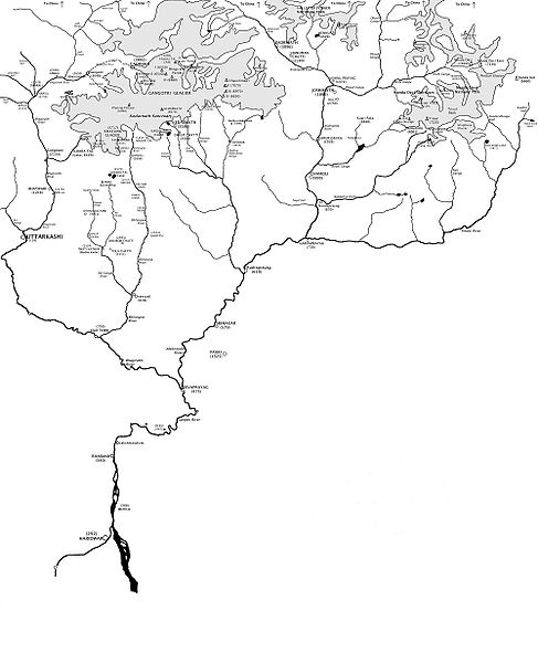
The figure above shows the main origin of the Ganges river whereas the map below follows the main route of the Ganges.

 India Ganges river home
 This, the main page of the Ganges river give complete information about everything the river represents and means to the world and manily the people who live along it.
 Where is the Ganges river
 Rebbecca from Rancho Cucamunga asks this rather important question and is provided with a detailed route of the Ganges river from Tony.
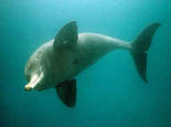 The India Ganges Dolphin
This amazing creature still somehow survives in the murky waters of the Ganges river although still greatly under threat from extinction.
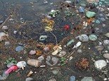 Ganges River Pollution
Follow this link for more information, pictures and insights into pollution in the Ganges river
Return to the All About India Homepage
From the Route of Ganges River
Navigation
Recent Articles
-
Difficulty in Life
Our life is full of difficulty Just have to know how to deal with Understand it Accept it Make way for it Make the best out of it -
Ancient India
 A modern look at Ancient India delves deep into India's past right back to the Indus valley civilisation and Looking deep into ancinet indian religion, culture and history
New! Comments
Have your say about what you just read! Leave me a comment in the box below.